

APP UPDATE
Busy roads and shared paths on the map
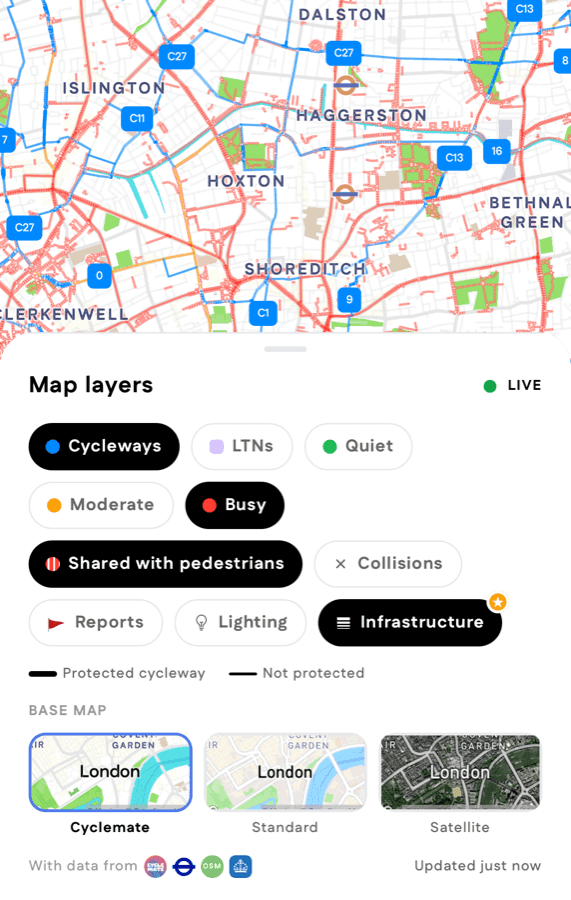
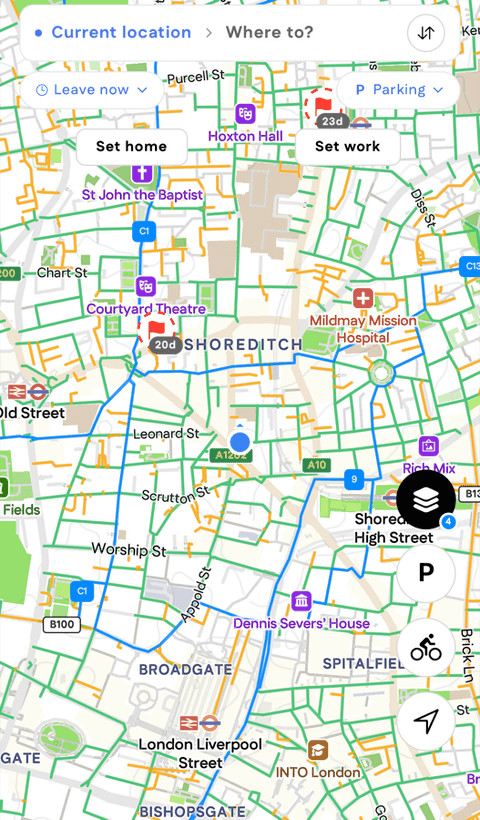
Three new map layers: busy roads, paths shared with pedestrians and, with Premium, which cycleways are protected. They work mid-ride too.
What’s new
Every change we ship, newest first. New things in the app, and changes to how SuperSafe picks your route. For launches, research and press, head to the newsroom.
7 updates
Three new map layers: busy roads, paths shared with pedestrians and, with Premium, which cycleways are protected. They work mid-ride too.
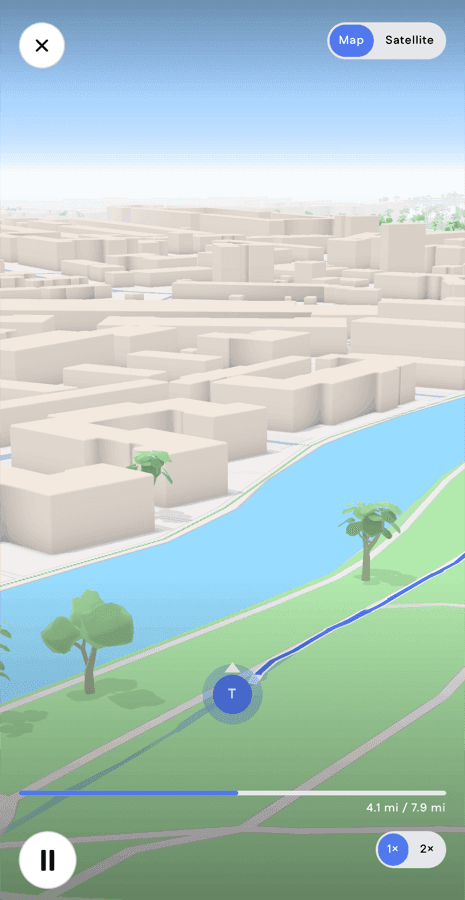
Open a ride in your history and tap play for a 3D fly-through of your route, on the map or satellite view. A Premium feature.
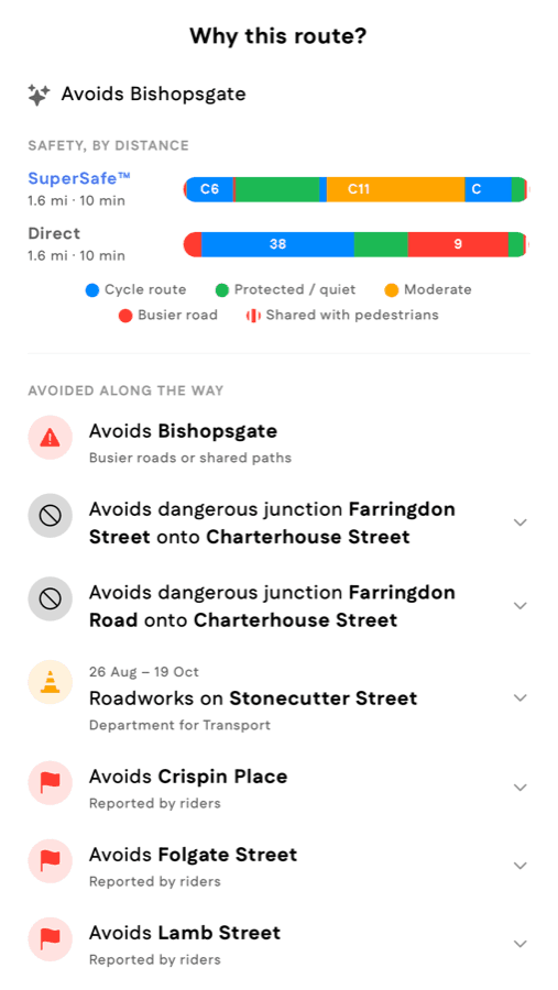
Tap Why this route? under any SuperSafe route to see its safety by distance, what it avoided along the way and the climb ahead.
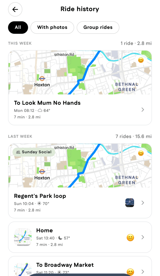
Rides are grouped by week with photos, ratings and reports at a glance. Filter to group rides or rides with photos, and see your latest rides on your profile.
Share route now offers a map card, one in your profile theme, and a safe-share card showing how much of the ride is quiet or protected.

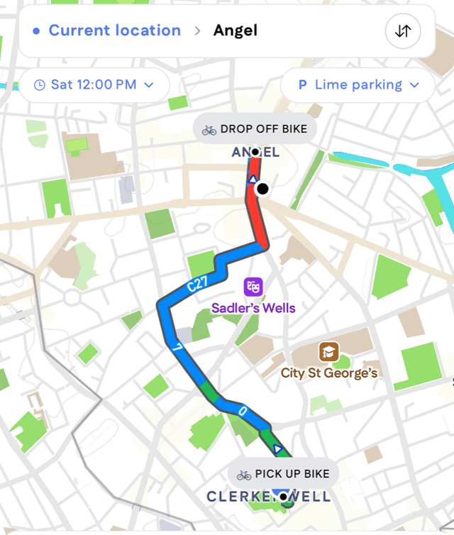
Lime and Forest routes now show where your hire can end, and the drop-off appears as a parking marker on the map.
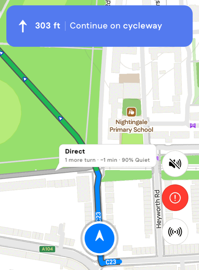
Turn on Route alternatives in Settings and Cyclemate shows the other route at each junction, with how many turns and minutes it saves. Tap it to switch.
5 updates
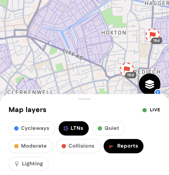
Tap the layers button to turn cycleways, quiet and moderate roads, low-traffic neighbourhoods, collisions, lighting and rider reports on or off.
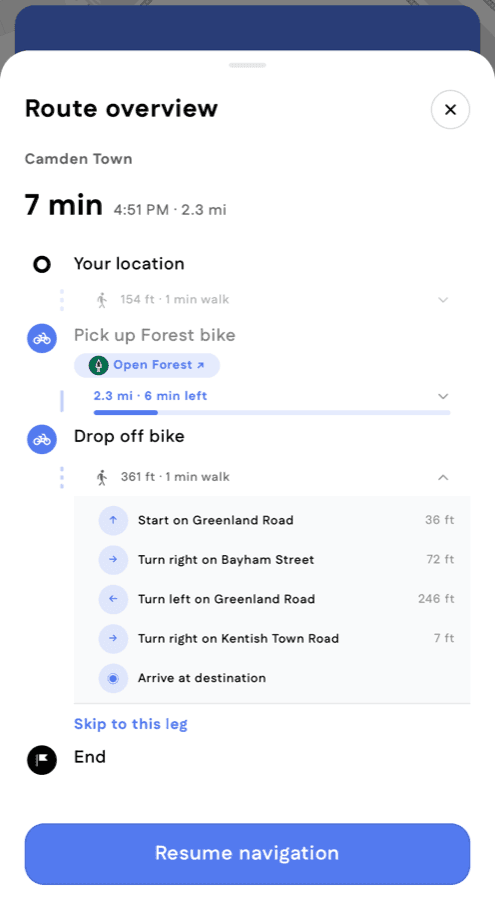
Tap the banner while navigating to see every stop, your progress, and the steps ahead.
See live Forest e-bikes near you and get routes that start on one. Tap a route to unlock in the Forest app.
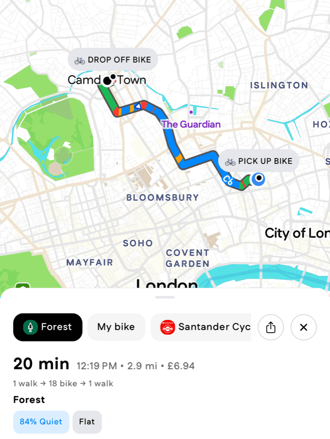
Trips can now start on a shared Forest e-bike. Riders see live bikes and battery range across London, pay-as-you-go pricing on each option, and a link that opens the bike in the Forest app. Where a borough requires shared e-bikes to end at a bay, the route now finishes at one.
Routes now try to hold a line for longer instead of zig-zagging between quiet streets for minor benefit.
16 updates
Cycleways on busy or risky roads now show in orange or red instead of blue, so blue always means a quiet, safe cycleway.
A no-turn restriction is now set aside only where both approaches are on the same cycleway. Routes stop suggesting turns that are signed against at junctions where a cycleway meets a road.
Signed London routes are now treated according to Transport for London's own guidance on what each is for. Cycleways and Superhighways are preferred over the streets beside them; Quietways and local network routes are treated as ordinary streets, because signage alone does not make a road calmer. This replaces a set of route-by-route adjustments made over the preceding months.
Streets with active works are still avoided, but less emphatically. Riders were being sent noticeably out of their way around works that were passable.
Where a route can continue straight rather than turn, it now does. This trims the zig-zagging through residential grids that made some quiet routes tiring to follow, and it only applies mid-run, so junctions where straight on is not really an option are unaffected.
Walking legs are now planned over footways, paths and crossings rather than over the cycling network. Where a street has no separately mapped pavement the carriageway is still available, so walking directions stay connected everywhere. Cycling turn restrictions no longer apply to walking legs, which is what previously produced the odd walking detour.
Routing now prefers to avoid uneven surfaces like gravel or cobblestones. Please keep reporting roads like this so we can increase/decrease how aggressively we avoid them!
We now track London road closures and street works daily, so your route steers around them while they last.
Where OpenStreetMap records a street or path as cobbled, gravel, dirt or otherwise uneven, routes now steer around it. Comfort and safety are treated separately: a rough street is avoided, but it is not reported as dangerous.
Road closures with a fixed start and end date, such as marathons, festivals and multi-week works, are now avoided for departures inside that window and ignored outside it. Pass departure_time to route for a specific day.
Riding a Lime or Forest e-bike? We can now route you to a designated parking bay near your destination, then walk you the rest.
Surface information published in OpenStreetMap now flows through to routing, which is what makes surface-aware routes possible. Values are consolidated to a simple smooth-or-uneven distinction, because the raw tagging is too inconsistent between contributors to use directly.
Routes will now avoid timed closures, like weekend markets. Pick a departure time to plan ahead.
The recurring closures for London's street markets are now recorded with their real trading hours, so a Saturday morning route around Broadway Market differs from a Tuesday afternoon one.
Roads that shut on a recurring weekly pattern, such as street markets and regular events, are now avoided for departures inside those hours and used normally the rest of the week. Before this, a route either always avoided the street or never did.
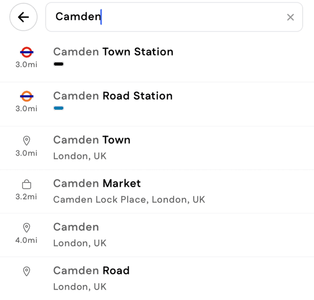
Tube, Overground, Elizabeth line and rail stations now show their roundels and line colours in search results.
10 updates
Routes now only turn you off your current heading if it meaningfully improves the safety of the trip. Please report any remaining strange detours!
Where a long street is recorded in several pieces, or is signed against the direction it was drawn, the cycleway alongside it now stays on the correct side. Routes stop putting riders on a lane running the other way.
Stretches of road that are not actually reachable from the rest of the city are now removed before routing. These were the source of routes that started or ended somewhere a rider could not get to.
The step that turns OpenStreetMap data into our road network was rewritten. Junctions, one-way rules and street naming are all more faithful to the source data, and the network takes considerably less time to rebuild, which is what made the nightly refresh below practical.
The area searched for a route now scales with how far apart the two points are. Long cross-city trips that previously failed to return a route now succeed, and short trips are unaffected.
Junctions where a turn is banned only at certain times, such as peak-hours-only restrictions, are now read from the map and honoured for the departure time you route for.
Where a street is one-way for bicycles, or explicitly two-way for bicycles on an otherwise one-way street, routing follows that rather than the general one-way rule. Contraflow lanes are usable in the direction they exist.
After dark, we now steer you onto well-lit streets. Check the "% Lit" pill on each route to see how much of it is lit.
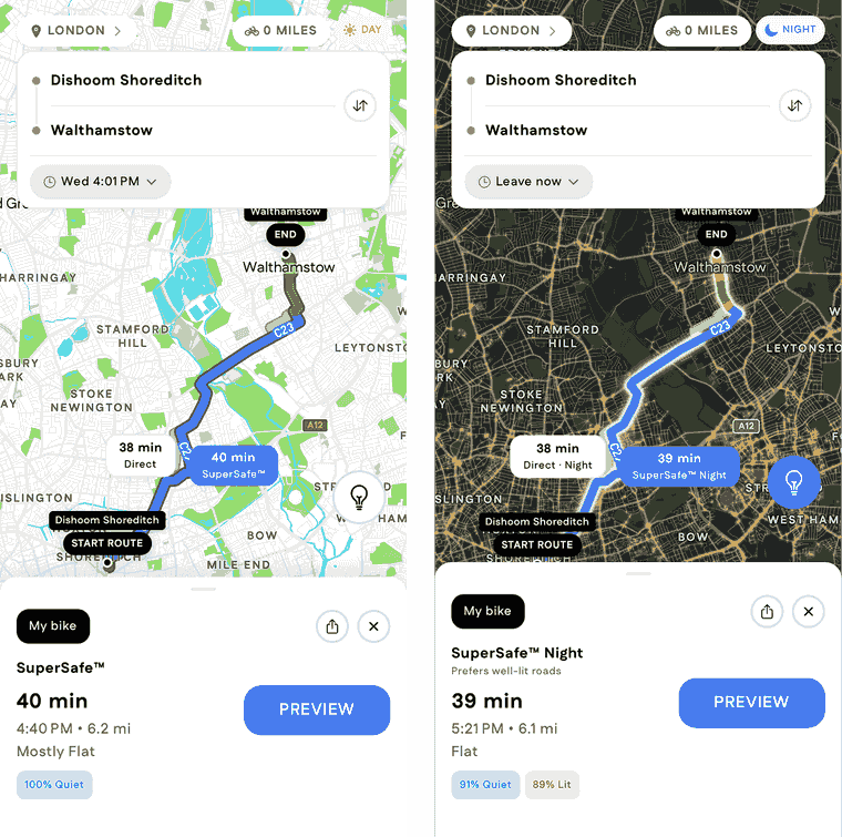
Evening and overnight trips now favour streets we know are lit. Night applies from half an hour after sunset to half an hour before sunrise, worked out for the route's own city, so it tracks the seasons rather than a fixed clock time. metadata.nighttime tells you which way a route was planned.
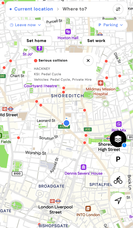
See where cyclists and others have been hurt on London roads. Filter by severity and who was involved, and tap a spot for details.
5 updates
See the safe cycling map of your city with live user reports and recent changes.
Where the safest route and the most direct route are the same road, only one option comes back rather than two identical ones. Riders were being asked to choose between two routes that were indistinguishable.
Every supported city now rebuilds from the latest OpenStreetMap data each night. A new cycle lane, a closed street or a corrected one-way now reaches routing within a day of being mapped, rather than whenever we next rebuilt by hand.
Tap the palette icon on your profile to add backgrounds, fonts, stickers, and more.
Turn restrictions recorded in OpenStreetMap, including no-left-turn and no-U-turn signs, are now enforced during route planning rather than checked afterwards. Routes also accept an optional starting direction, so a rider already moving is not told to turn around.
3 updates
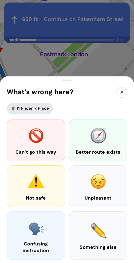
While riding hit the report button, we'll investigate and notify you with updates.
Where a route starts partway along a street, the opening step now reports the correct departure direction. It could previously be reported as the opposite direction, which sent riders the wrong way out of the gate.
Cycleways drawn as their own line alongside a road, which is how most protected lanes are mapped, are now matched to the street they run beside. Turn-by-turn steps name the street rather than an unnamed parallel path, and a lane on one side of a road only helps riders travelling that way.
3 updates
How strongly each kind of road is preferred or avoided is now set per city and can be changed without rebuilding anything. A busy arterial in London and one in Los Angeles no longer have to be treated identically, and a correction reaches riders the same day.
Where a signed cycle route runs parallel to a road, routing now prefers the signed route. This is what makes a SuperSafe route follow the network a city has actually built.
1 update
supersafe switches routing between the safety-first model and the most direct route, resolved against the city the request falls in. Before this, safety routing was all or nothing.