

Seeing London's Roads After Dark: Street Lighting and Collisions on the Map
Two new data layers on the London map: every lit and unlit road, and recent bike collisions (2025 onward), so you can see why a route is safe, not just trust that it is.
By Kyle
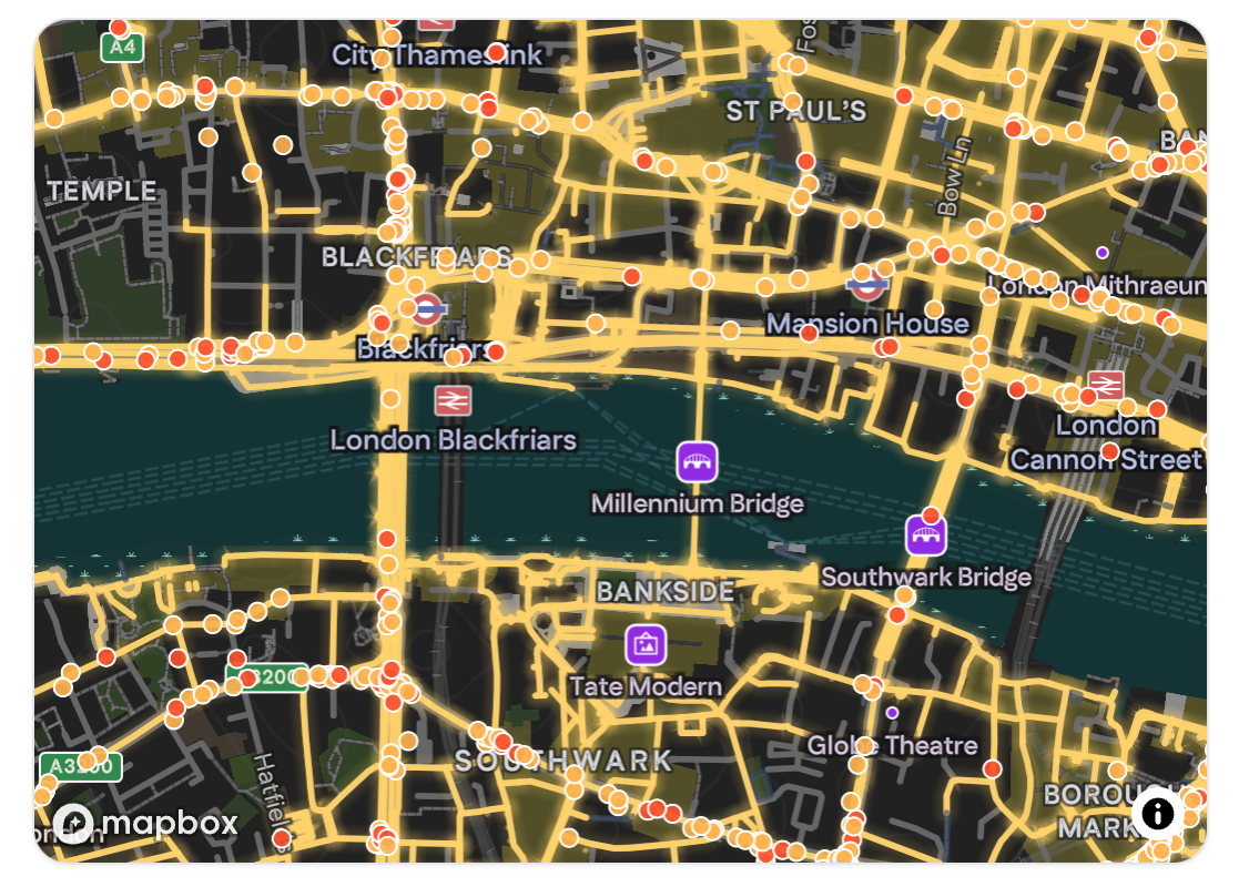
Cyclemate has always picked the safest roads for you. The harder question is the one riders actually ask at the junction: why this road and not that one? Today we're answering part of it out loud. Two new data layers are now live on the London map: street lighting and road collisions, and you can explore both right here in this post.
Where the danger actually is
Safe routing starts with knowing where people get hurt. We've layered Transport for London's road-collision records onto the map: every recorded collision from 2025 onward, graded by severity (slight, serious, and fatal) and filterable by who was hurt and what was involved.
The map below opens on cyclists killed or seriously injured (what road-safety people call "KSI"). The hotspots won't surprise anyone who rides in London: the big gyratories, the bridge approaches, the junctions where a cycle lane evaporates into four lanes of traffic. Tap a point to read the detail; use the chips to switch between cyclist KSI, cyclist-versus-motor-vehicle, pedestrians, or every fatal collision since 2025.
Seen all at once, the pattern is the argument. Collisions aren't scattered evenly across the city. They cluster, hard, on a small number of roads and junctions. Those are exactly the places SuperSafe™ routing works to keep you off. The map doesn't just show you a safe line through the city; now it shows you the danger that line is steering around.
Collision data reflects what was reported and recorded, and a collision-free street isn't automatically a safe one; it may simply be one nobody cycles on yet. We treat this as one signal among many, not the whole story.
The other half of safety: can you be seen?
Daytime danger is only half of it. A huge share of cycling happens in the dark (winter commutes, evening rides home), and a well-lit road is a fundamentally different place to ride than an unlit one. So we mapped that too.
Using OpenStreetMap's lighting data, the night view flips the map to a dark basemap and paints every road by whether it's lit. Lit roads glow warm amber; unlit roads sit in cold, dim blue. It's the clearest possible picture of which way home keeps you visible after sunset.
Lighting coverage from OpenStreetMap is approximate. It's community-maintained, so think of it as indicative rather than a council audit. But even approximate, the contrast is striking: the lit arterials stand out like a circuit diagram, and the dark gaps between them are precisely the stretches worth planning around on a late ride. We're working toward folding lit/unlit status directly into routing, so a night-time route can prefer the lit way home automatically.
Why we're putting the data on the table
Plenty of apps will hand you a route and ask you to trust it. We'd rather show our working. A route is more convincing, and easier to overrule with local knowledge, when you can see the collision cluster it avoids and the lit road it favours.
Both layers are live now on the London map. Pan, zoom, toggle, and tap around. They're London-only for the moment while we prove out the data; other cities will follow as we bring the same sources online.
Got a road that the data gets wrong? A junction that feels far worse than it looks, or a lit street the map thinks is dark? That's exactly the kind of feedback that makes the next ride safer. Tell us in the app, or email [email protected].
Notes & sources
- Collision data: Transport for London road-collision records, limited to collisions from 2025 onward so the map reflects current road conditions. Severity bands (slight / serious / fatal) and casualty/vehicle categories follow the source data.
- Street lighting: © OpenStreetMap contributors (ODbL). Derived from
littags on the road network and mapped street-lamp points; coverage is approximate. - Both layers are available today on the London map only.